Lodging nearby Condomínio Sacir
Angola
Lodging nearby Condomínio Sacir
Condomínio Sacir
Luongo, GGG7+X3X, Catumbela, Angola
contacts phone
:
+244
Latitude:
-12.4725019
, Longitude:
13.5127486
larger map & directions
read more
nearest Lodging
57 m
Condomínio Nova Esperança
GGG7+V7W, Catumbela
Lodging
Point of interest
Establishment
read more
1.584 km
Mavenda & Marques
GGQC+HJ2, Lobito
Lodging
Point of interest
Establishment
read more
1.963 km
CASA DA FAMÍLIA NASCIMENTO
GGPH+J7X, Catumbela
Lodging
Point of interest
Establishment
read more
2.144 km
FFH - Loja Centralidade do Lobito
GGHM+42J, Unnamed Road, Catumbela
Lodging
Point of interest
Establishment
read more
3.102 km
Vasco Hamuyela
GGVP+8G7, Catumbela
Lodging
Point of interest
Establishment
read more
4.786 km
Hotel Riomar
HG5V+99F, Lobito
Lodging
Point of interest
Establishment
read more
5.595 km
Hotel Do Kamgamba
HH62+J78, Catumbela
Lodging
Point of interest
Establishment
read more
5.597 km
Hotel Kabuscorp
HH62+J82, Catumbela
Lodging
Point of interest
Establishment
read more
5.702 km
Vivenda Denzel
HFGW+JX, Catumbela
Lodging
Point of interest
Establishment
read more
5.755 km
luanda
Rua da Madre Efígenia de Carvalho 2ª, Catumbela
Lodging
Point of interest
Establishment
read more
11.97 km
cantinho da Lucy
AV.Brasil, Lobito
Lodging
Point of interest
Establishment
read more
13.228 km
Guest House Ship Chandler (Compão)
Bairro do Compão, Rua de Moçâmedes Nº 9 Benguela, Lobito
Lodging
Point of interest
Establishment
read more
16.231 km
Hotel Misinga
CCG3+GX5, Rua 31 de Janeiro, Benguela
Lodging
Point of interest
Establishment
read more
17.424 km
Residencial Yellow House
dos Açores n10, Rua Vasco da Gama, Benguela
Lodging
Point of interest
Establishment
read more
18.668 km
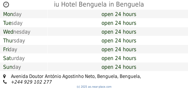
iu Hotel Benguela
Avenida Doutor António Agostinho Neto, Benguela
Lodging
Point of interest
Establishment
read more
📑
all categories
Accounting
Administrative area level 1
Administrative area level 2
Airport
Amusement park
Atm
Bakery
Bank
Bar
Beauty salon
Book store
Bus station
Cafe
Campground
Car dealer
Car rental
Car repair
Car wash
Casino
Cemetery
Church
Clothing store
Convenience store
Courthouse
Dentist
Department store
Doctor
Electrician
Electronics store
Embassy
Establishment
Finance
Fire station
Florist
Food
Funeral home
Furniture store
Gas station
General contractor
Grocery or supermarket
Gym
Hair care
Hardware store
Health
Home goods store
Hospital
Insurance agency
Jewelry store
Laundry
Lawyer
Library
Liquor store
Local government office
Locality
Lodging
Meal delivery
Meal takeaway
Mosque
Movie theater
Moving company
Museum
Natural feature
Neighborhood
Night club
Park
Parking
Pet store
Pharmacy
Physiotherapist
Place of worship
Point of interest
Police
Post office
Premise
Real estate agency
Restaurant
Route
Rv park, camping
School
Shoe store
Shopping mall
Spa
Stadium
Storage
Store
Supermarket
Synagogue
Taxi stand
Train station
Transit station
Travel agency
University
Veterinary care
sublocality level 1
↑