Lodging nearby Hospedaria oavave
Angola
Lodging nearby Hospedaria oavave
Hospedaria oavave
Rua da IEPA, kimbumba, Santo António do Zaire, Angola
contacts phone
:
+244 923 021 244
Latitude:
-6.1478161
, Longitude:
12.3838284
larger map & directions
read more
nearest Lodging
296 m
Residência Maria Jaime
V92P+368, Soyo
Lodging
Point of interest
Establishment
read more
1.409 km
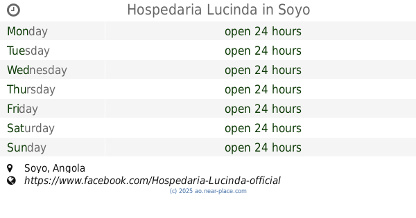
Hospedaria Lucinda
Soyo
Lodging
Point of interest
Establishment
read more
1.604 km
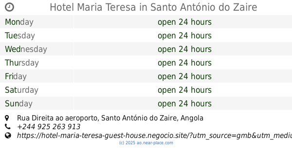
Hotel Maria Teresa
Rua Direita ao aeroporto, Santo António do Zaire
Lodging
Point of interest
Establishment
read more
1.696 km
Ariel francisco
V929+X9X, Rua da máfia, Santo António do Zaire
Lodging
Point of interest
Establishment
read more
1.87 km
Oui Hotel
Bairro Kindombele, Santo António do Zaire
Lodging
Point of interest
Establishment
read more
1.885 km
TGFA rua 1
V98F+24J, Soyo
Lodging
Point of interest
Establishment
read more
1.886 km
Nenbumba Residencial
Soyo
Lodging
Point of interest
Establishment
read more
2.311 km
Hospedaria. Kifuma
RUA DIREITA DO AEROPORTO CASA Nº. 299, Santo António do Zaire
Lodging
Point of interest
Establishment
read more
2.314 km
Hotel Nempanzu
Rua do Matadouro, S/N, Santo António do Zaire
Lodging
read more
3.041 km
JEMBAS
V9F8+CMP, Soyo
Lodging
Point of interest
Establishment
read more
3.078 km
Hotel Jacilina
Soyo
Lodging
read more
3.326 km
Hotel Casmad
V9F7+G5G, Casmad, Santo António do Zaire
Lodging
Point of interest
Establishment
read more
3.926 km
João Marcelino Nenkamba
V9G4+8XX, Soyo
Lodging
Point of interest
Establishment
read more
3.953 km
Hotel Mpampa
Soyo
Lodging
read more
4.051 km
Hotel Mavacala
V9H5+JMJ, Unnamed Road, Santo António do Zaire
Lodging
Point of interest
Establishment
read more
📑
all categories
Accounting
Administrative area level 1
Administrative area level 2
Airport
Amusement park
Atm
Bakery
Bank
Bar
Beauty salon
Book store
Bus station
Cafe
Campground
Car dealer
Car rental
Car repair
Car wash
Casino
Cemetery
Church
Clothing store
Convenience store
Courthouse
Dentist
Department store
Doctor
Electrician
Electronics store
Embassy
Establishment
Finance
Fire station
Florist
Food
Funeral home
Furniture store
Gas station
General contractor
Grocery or supermarket
Gym
Hair care
Hardware store
Health
Home goods store
Hospital
Insurance agency
Jewelry store
Laundry
Lawyer
Library
Liquor store
Local government office
Locality
Lodging
Meal delivery
Meal takeaway
Mosque
Movie theater
Moving company
Museum
Natural feature
Neighborhood
Night club
Park
Parking
Pet store
Pharmacy
Physiotherapist
Place of worship
Point of interest
Police
Post office
Premise
Real estate agency
Restaurant
Route
Rv park, camping
School
Shoe store
Shopping mall
Spa
Stadium
Storage
Store
Supermarket
Synagogue
Taxi stand
Train station
Transit station
Travel agency
University
Veterinary care
sublocality level 1
↑